UW-Madison research helps predict landslides along Wisconsin coast
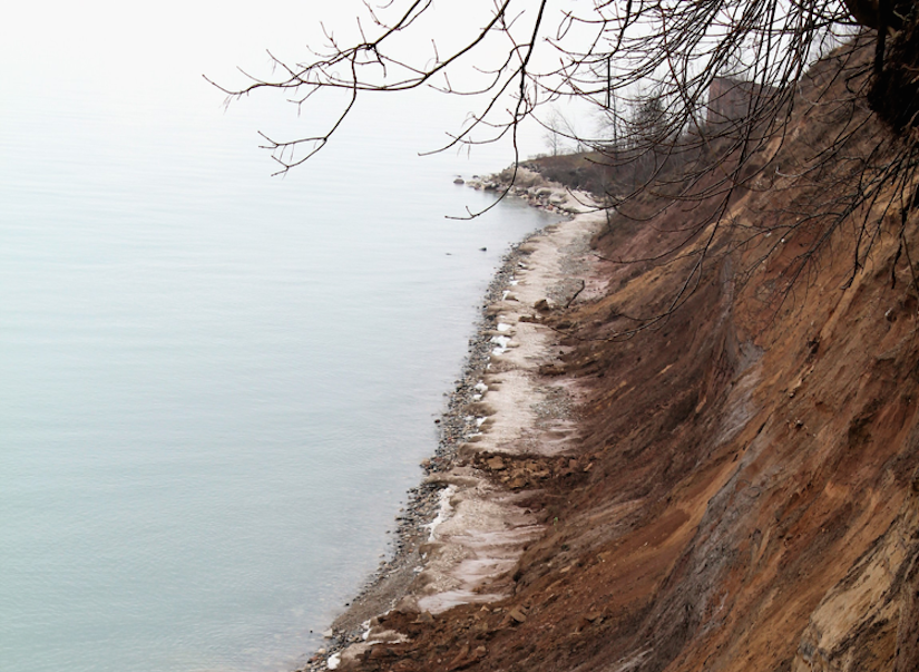
Lake Michigan coastal bluffs near Milwaukee. Photo by Luke Zoet.
Luke Zoet
The model could enable him to warn counties about when and where bluffs might fail, or which beaches they can expect to be replenished with sand.Zoet’s project, which received seed funding from the Sea Grant Institute at UW-Madison, initially focused on Mt. Pleasant in Racine County, Wisconsin. “It’s experienced quite high levels of erosion simply because there hasn’t traditionally been a lot of protection there,” he says. “So some areas undergo a lot of erosion. The people living at the top of the bluffs normally don’t realize erosion is a problem in a lot of cases until it’s too late when the bluff is really steep. It’s really hard to protect it at that point.” Zoet and his team developed a specialized tool they call the BADGER (which is far less of a mouthful than “bluff assessment data generating experiment recorder”). “It’s basically like a fishing pole,” Zoet says. “It has a line that comes out of it. If you pull on the line, the baler unspools and lets more of the line out. The fishing pole is stuck on the part of the bluff that we think is not going to have a landslide. As a landslide starts to move, it basically pulls the line out. It gives an accurate measure of how those two things are moving relative to each other.” On Dec. 13, 2016, the BADGER captured and recorded its first landslide. “Before this landslide catastrophically broke apart and fell down the bluff, it started moving at a pretty high rate,” he says. For two and a half hours before it failed, it moved even faster. With this data, Zoet used techniques normally applied in materials science to determine what caused the landslide. “The material was somewhere between unfrozen soil and frozen soil and there was an 11-degree Celsius temperature drop from -1 to -12 right before the bluff failed,” he says. “What we think happened was when the temperature dropped, groundwater that was in the bluff started to freeze and wedged a crack open. That opening is what caused the landslide.” Zoet set up two more BADGERs: a second one in Mt. Pleasant and one near Port Washington. All three recorders are now showing movement in the landscape, but there haven’t been any landslides. The existing data is encouraging enough to expand his project. Moving forward, he’d like to take measurements of all failing bluffs along the coast of Lake Michigan and estimate what causes them to fail, and what materials will be deposited into the water if they do. It’s important because if the failing bluffs have a lot of sand in them, the sand can rebuild the beaches in that area. Meanwhile, a failed bluff with clay will just float into the water and be lost forever. Furthermore, he intends to learn from the past. “In the 1970s when the water line was high, all bluffs along the coast were exposed and geologists wrote up what they are made of,” he says. “So we’re going to digitize that data and put it into a model.” The model could enable him to warn counties about when and where bluffs might fail, or which beaches they can expect to be replenished with sand. “We’re trying to accurately measure the properties that are changing leading up to a landslide,” he says. “Our goal is not to prevent them. We want to figure out why and how they occur so that we can better estimate when and where they might happen in the future.” Peter Jurich| College of Engineering